

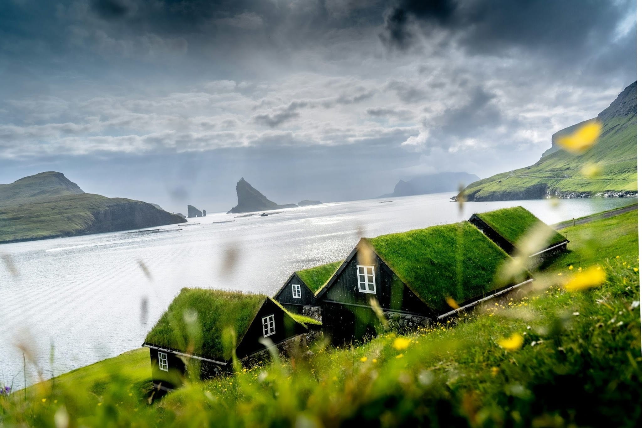
Facts About the Faroe Islands
There are many facts about the Faroe Islands that help explain why this small territory in the North Atlantic feels so different from other European destinations. The Faroe Islands combine dramatic mountains, villages facing the sea, narrow fjords and a culture shaped by geographical isolation. Although they are often associated with Denmark, they have their own government, national language and a very distinctive Nordic identity. For travellers who want to discover the Faroe Islands on a personalised journey, understanding this geography and history makes every landscape more meaningful.
Where is the archipelago located?
One of the first questions about the Faroe Islands concerns their location. The archipelago lies in the North Atlantic, approximately between Iceland and Norway, northwest of Scotland. Among the facts about the Faroe Islands, this position explains the oceanic climate, the constant presence of wind and the strong relationship between Faroese people and the sea. On broader maps, the territory may appear to be little more than a collection of points between large landmasses, but the islands occupy a strategically significant maritime area in the Atlantic Ocean.
When researching facts about the Faroe Islands, one of the most common questions is exactly where they are located. A common simplified answer is “between Scotland and Iceland”. This is accurate as a general reference, but it does not reveal the complexity of the destination. The Faroe archipelago consists of 18 main islands of volcanic origin, as well as smaller islets and rock formations. The expression “18 larger islands” also appears in searches, although “18 main islands” is a more accurate description. Most of these 18 islands are inhabited, although some have very small communities.
The volcanic landscape is one of the central facts about the Faroe Islands. Successive layers of basalt created sloping plateaus, deep valleys and coastal cliffs that appear to fall directly into the sea. Instead of extensive beaches or large flat areas, the landscape is dominated by green slopes, narrow channels and rugged coastlines. This geological structure turns journeys between the islands into a sequence of tunnels, bridges, coastal roads and sea crossings.
Mountains, fjords and landscapes shaped by the Atlantic
The highest mountains in the Faroe Islands are mainly concentrated in the northern regions. Some exceed 800 metres in height, which may seem moderate compared with major mountain ranges, but they appear particularly imposing because the peaks rise almost directly from sea level. The highest point is Slættaratindur, at 880 metres, according to geographical data published by Statistics Faroe Islands.
The combination of altitude, cliffs, mist and sea creates some of the destination’s most recognisable natural scenery. Each fjord leads to a different landscape, while the light changes quickly as clouds move across the sky. From certain viewpoints, several islands can be seen at once; elsewhere, the terrain completely blocks the view and creates a strong sense of isolation. These conditions help explain why facts about the Faroe Islands are so often connected to the scale of nature and the way local communities have adapted to the territory.
| Feature | Interesting fact | Impact on the experience |
|---|---|---|
| Geological origin | The archipelago is mainly formed from volcanic basalt rock | Creates cliffs, deep valleys and layered mountains |
| Oceanic location | Located between Iceland, Norway and Scotland | The weather can change several times during the same day |
| Terrain | Several peaks exceed 800 metres | Natural landscapes appear higher because of their proximity to the sea |
| Human settlement | Communities are concentrated in sheltered coastal areas | Villages are nestled between mountains and water |
These facts about the Faroe Islands reveal a territory where geology, climate and human settlement are directly connected. The lack of large plains forced communities to make use of small coastal areas, while the sea remained a route of communication, a source of food and a central part of the economy.
From Norway to Denmark: a distinctive form of autonomy
The political situation is also one of the facts about the islands that most surprises visitors. The islands were settled by Nordic communities and maintained a historical relationship with Norway for centuries. Following political changes in Northern Europe, the territory became part of the Danish monarchy. In 1814, the Treaty of Kiel separated Norway from Denmark, but the Faroe Islands, Greenland and Iceland remained under the Danish Crown.
Simply saying that the territory is part of Denmark does not tell the whole story. The Faroe Islands are an autonomous nation within the Kingdom of Denmark, with their own parliament, government and areas of responsibility. The current system of self government has been in place since 1948 through the Home Rule Act. The official Faroe Islands Government description of the political and legal status of the Faroe Islands explains that the autonomy agreement came into force that year.
In practice, the Faroe Islands are locally administered in many areas, while certain matters remain connected to the Kingdom of Denmark. This structure helps explain why the territory has its own institutions without being an independent state. It also avoids overly simplistic comparisons with Iceland, which became a sovereign republic, or Norway, which followed a different political path. The relationship with Iceland and Norway is relevant for understanding the islands’ Nordic cultural roots, but it does not define the contemporary political status of the Faroe Islands.
- One of the facts about the Faroe Islands is that they have a local parliament known as the Løgting.
- Modern self government has been in place since 1948.
- The islands maintain a constitutional connection with the Kingdom of Denmark.
- Faroese is the main expression of cultural and political identity.
Why the Faroe Islands have their own currency and language
Among the facts about the Faroe Islands connected to everyday life, the local currency is one of the clearest examples of their autonomy. The Faroese króna uses its own banknotes but has the same value as the Danish krone. The coins used in the archipelago are Danish, and Danish banknotes are also accepted. Prices, bookings and payments commonly use the abbreviation DKK. Therefore, there is no variable exchange rate between the Faroese and Danish currencies, as both circulate at parity. This is one of the most useful facts about the islands for travellers starting to plan their trip budget.
Another important fact about the Faroe Islands concerns the national language: Faroese, a language of Nordic origin that maintains historical links with Icelandic and older forms of Norwegian. Danish is taught in schools, and English is widely understood, particularly in tourism related services. Even so, signs, place names, media and everyday conversations demonstrate that Faroese is not merely symbolic. It remains at the heart of Faroese identity.
This combination of a distinct language, local currency and self government appears repeatedly when researching facts about the Faroe Islands. It shows that the archipelago should not be treated simply as a remote extension of Denmark. Its culture developed through contact with other Nordic territories, but also through relative isolation, which contributed to the preservation of traditions, oral storytelling and distinctive forms of community organisation.
Tórshavn, a small European capital linked to Thor
Among the facts about the Faroe Islands connected to urban life, Tórshavn stands out. The capital of the Faroe Islands is located on the island of Streymoy. Its name can be translated as “Thor’s harbour”, referring to the god Thor from Norse mythology. The city developed around a sheltered harbour and remains the main administrative, cultural and commercial centre of the archipelago. Despite this role, it remains small compared with any major European capital.
Tórshavn contains some of the most visible facts about the Faroe Islands for visitors arriving at the destination. In the historic Tinganes district and the old streets close to the harbour, wooden houses are painted black, red and other colours. Many have white windows and grass covered roofs. These roofs were not created simply to produce a picturesque appearance: vegetation covered roofing is part of a traditional building method adapted to the climate, wind and locally available materials.
Colourful houses stand alongside public buildings, restaurants, cultural spaces and contemporary structures. This contrast reflects some of the facts about the Faroe Islands that best represent the capital. It makes Tórshavn an important base for understanding how tradition and modern life coexist across the archipelago. Within just a few minutes on foot, visitors can pass the historic houses of Tinganes, watch boats in the harbour and enter newer urban areas. To expand the journey beyond the capital, Atelier Travel’s Nordic destinations page presents other territories connected through landscape, climate and the cultural heritage of Northern Europe.
Looking at Tórshavn and the island of Streymoy, it becomes clear that the facts about the Faroe Islands are not dependent on grand monuments. They can be found in the scale of the neighbourhoods, Nordic place names, wooden architecture, the constant presence of the sea and the way a small community preserves its own institutions. This perspective is essential for discovering the Faroe Islands beyond photographs of mountains and understanding why the archipelago maintains such a distinctive identity.
When planning a trip to the archipelago, the most practical questions usually concern flights, weather, transport and which islands to visit. These facts about the Faroe Islands show that the destination requires some preparation, but the logistics are not particularly complicated when the itinerary is organised by region. Flights arrive on the island where the airport is located, while the capital serves as the main urban base. From there, tunnels, bridges, ferries and scenic roads make it possible to explore a significant part of the archipelago without losing the feeling of being in a remote territory.
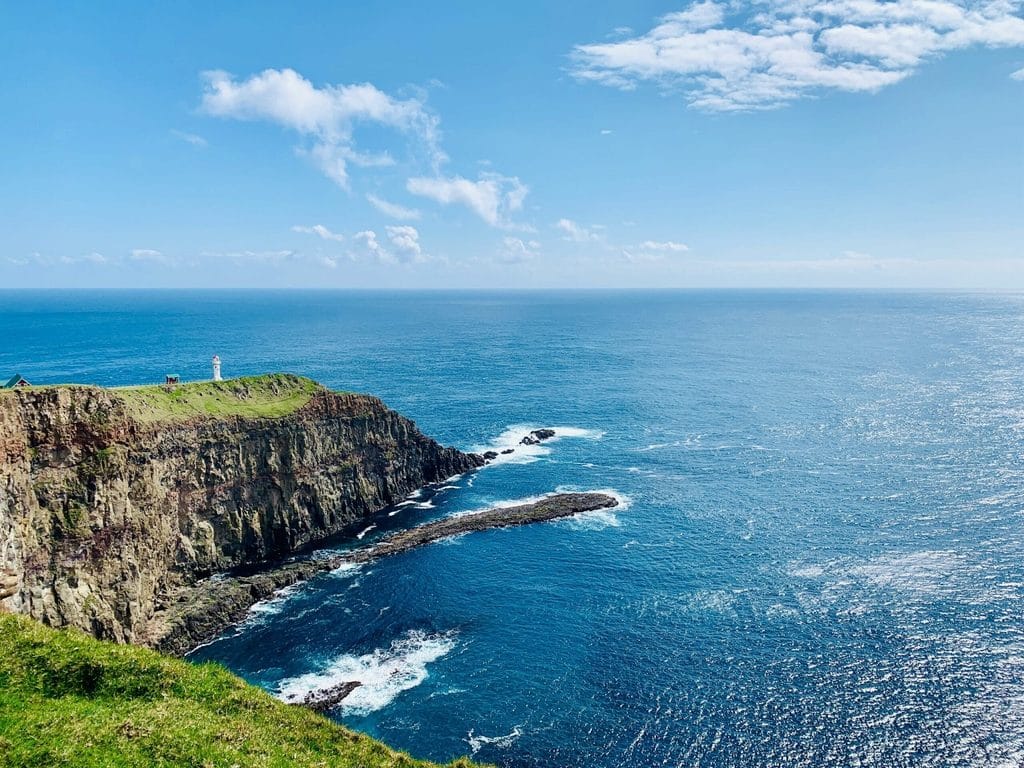
Facts about the Faroe Islands: how to get there by plane
Among the most useful facts about the Faroe Islands for trip planning is how to reach the destination. Travellers visiting the Faroe Islands from Brazil or Portugal normally need to make at least one connection in another European city. Regular flights from Portuguese or Brazilian airports require a connection, as there are no direct flights to the archipelago. Copenhagen is one of the most practical connections, with frequent services to Vágar Airport. Reykjavik and Edinburgh may also be included in the itinerary, although availability and frequency vary depending on the season.
Another of the facts about the Faroe Islands is that the territory’s main airport was built on the island of Vágar rather than on the island where the capital is located. The airport is connected to the main inhabited areas by road and an underwater tunnel. The drive to Tórshavn usually takes around 45 minutes, depending on weather and traffic conditions.
The Faroese airline operates regular services to several European cities. The Copenhagen route operates throughout the year, while other connections may be seasonal or have fewer weekly frequencies. Before purchasing each flight, it is important to confirm schedules, baggage rules and possible changes directly on the official page explaining how to get to the Faroe Islands. To travel to the Faroe Islands with greater peace of mind, it is also advisable to leave sufficient time between connections, especially when tickets have been issued separately.
Do Portuguese citizens need a visa?
For tourist visits, citizens of Portugal and other European Union countries do not need a visa or specific travel authorisation. In other words, Portuguese citizens do not need to apply for a visa before travelling, provided they comply with the rules applicable to the duration and purpose of their stay. Travellers may use a valid passport or, under conditions recognised by the local authorities, a national identity document with a photograph.
One of the facts about the Faroe Islands is that the territory should not be treated in exactly the same way as mainland Denmark for entry purposes. A residence permit or visa valid for the Schengen Area does not automatically guarantee entry to the islands in every case. Travellers who are not European citizens should check the specific requirements before departure, even if they legally reside in Portugal or another European country.
Islands, villages and landscapes to include in the itinerary
When turning these facts about the Faroe Islands into an itinerary, it is not necessary to try to visit every island during a single trip. A good itinerary combines places connected by road with one or two boat crossings. The island where the capital is located and the airport region include important attractions and work well for a first visit. The northern islands offer more dramatic mountains, small villages and roads passing through narrow tunnels.
| Island or region | Key locations | Main experience |
|---|---|---|
| Streymoy | Capital, Saksun and Kirkjubøur | History, gastronomy and logistical base |
| Vágar | Bøur and Gásadalur | Lakes, waterfalls, cliffs and viewpoints |
| Eysturoy | Gjógv and Eiði | Coastal villages and mountain landscapes |
| Northern region | Kalsoy, Borðoy, Viðoy and Kunoy | Tunnels, hiking trails and remote communities |
| Mykines | Main village and coastal areas | Seabirds and hikes dependent on weather conditions |
Among the facts about the Faroe Islands connected to the landscape, Miðvágur is a gateway to some of the most photographed natural scenery. Gásadalur combines a small community with Múlafossur waterfall, which drops towards the sea. This island, in turn, is sought after for its seabird colonies and coastal walks, although crossings depend on ocean conditions and should never be considered guaranteed.
In the Faroe Islands, a realistic plan is more valuable than an extensive list. One of the facts about the Faroe Islands is that the weather can disrupt a crossing, close a trail or reduce visibility within minutes. For this reason, villages and islands should be organised according to the location of the accommodation and available transport connections, avoiding excessive travel during the same day.
Klaksvík, located on Borðoy, sometimes written as Bordoy in searches that do not use Faroese characters, is the main town in the northern part of the archipelago. From this region, travellers can reach Vidoy, a simplified spelling of Viðoy used by some systems, and continue to Viðareiði, surrounded by mountains and sea. This island requires a ferry crossing and is known for its tunnels, trails and villages aligned along a narrow strip of land.
What to do in the Faroe Islands besides hiking
The facts about the Faroe Islands are not limited to hiking. They are also reflected in maritime experiences and in the Faroese relationship with the ocean. Walking activities are one of the main ways to appreciate the natural scenery, but they are not the only option. A boat trip can reveal cliffs from sea level, enter areas close to coastal caves or cross a sheltered fjord. Operations always depend on wind and sea conditions, meaning schedules may be adjusted on the day itself.
Visitors can also explore museums, churches, harbours, studios and restaurants focused on local ingredients. Fish, lamb and seafood frequently appear in Faroese cuisine. Birdwatching is particularly significant in coastal areas, while seals and whales may occasionally be seen in the surrounding waters, although sightings can never be guaranteed.
National Geographic presents the scenic roads of the Faroe Islands as a central part of the experience. Renting a car provides flexibility to adapt the day according to clouds, rain and visibility. Even so, drivers must respect speed limits, animals on the road, single lane tunnels and parking rules in villages.
Facts about the Faroe Islands: when to travel and how to understand the weather
Another of the facts about the Faroe Islands is the influence of the Gulf Stream, which moderates temperatures despite the northern latitude. The climate is oceanic, with cool summers, relatively mild winters, frequent wind and rapidly changing conditions. This makes it possible to visit the territory throughout the year, although each season requires different expectations.
During summer, long days make outdoor activities, journeys and boat trips easier. This is also the busiest period, with more visitors and greater demand for accommodation and rental vehicles. Winter brings fewer daylight hours and a quieter atmosphere, although some experiences, crossings and services operate with reduced availability.
- Bring a waterproof outer layer, even when the forecast predicts dry weather.
- Wear suitable footwear for wet, uneven and muddy surfaces.
- Check local conditions before starting longer routes.
- Avoid approaching cliff edges during strong winds or fog.
- Keep alternative plans for days when visibility limits outdoor activities.
These tips for visiting the islands do more than improve comfort. They reduce risks and help preserve the territory. Some trails cross private property, require payment or are subject to seasonal restrictions. Anyone visiting the Faroe Islands should respect signs, gates, nesting areas and guidance from landowners.
Where to stay and how to travel between the islands
When turning the facts about the Faroe Islands into practical decisions, choosing the right base makes a difference. For travellers deciding where to stay, the capital is the most versatile option. The city offers the widest range of hotels, restaurants and services, as well as a useful position for exploring the main island and reaching other regions. The airport area can be useful for nights close to arrival or for focusing visits on the western region. Klaksvík is better suited to itineraries prioritising the northern region.
Among the facts about the Faroe Islands, the network of underwater tunnels stands out for having significantly reduced travel times. Some passages require payment, while other roads and tunnels do not have direct tolls. Ferries remain essential for certain destinations, including islands without road connections.
When planning a trip to the Faroe Islands, it is advisable to group visits by area. This is one of the facts about the Faroe Islands that most influences the actual pace of an itinerary. Trying to cross the archipelago several times within the same day reduces the amount of time available in villages and increases dependence on weather conditions. A personalised itinerary also helps combine accommodation, transport and activities according to each traveller’s preferred pace. Atelier Travel’s travel tips for Iceland and Nordic destinations section includes additional content that can support this preparation.
The facts about the Faroe Islands can also be discovered during the journeys themselves: narrow roads follow mountain slopes, tunnels lead to small communities and the view can change completely within just a few kilometres. To discover the Faroe Islands in greater depth, it is worth allowing time for spontaneous stops rather than turning every day into a rigid sequence of attractions.
Contact
To turn these facts about the Faroe Islands into an itinerary adapted to your travel profile, contact the Atelier Travel team through the contact page and request a personalised proposal for discovering the archipelago.ased on your culinary interests, providing access to some of the most authentic food experiences in Iceland.